MapTalk debuts in railway design: community contributing to RegioExpres
A shorter travel time, more seating, and better connections to intercity trains for passengers traveling to and from the Randstad. An additional express train alongside the current local trains, the RegioExpres, aims to improve the accessibility of the Liemers and Achterhoek regions. Between March 8th and 31st, desires, ideas, as well as concerns and focal points were gathered regarding the draft designs. Citizens, businesses, societal organizations, and (co-)government bodies provided over 231 responses on the MapTalk app.
With over 21,000 passengers, the train service between Arnhem and Winterswijk is the busiest regional rail line in the Netherlands. Doubling the track between Didam and Doetinchem De Huet stations is set to lay the groundwork for the RegioExpres. This also includes potential modifications to stations such as Doetinchem De Huet and Wehl, the renovation of Doetinchem De Huet station, and an additional platform at Wehl station.
Mapping the RegioExpres
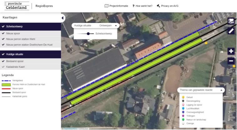
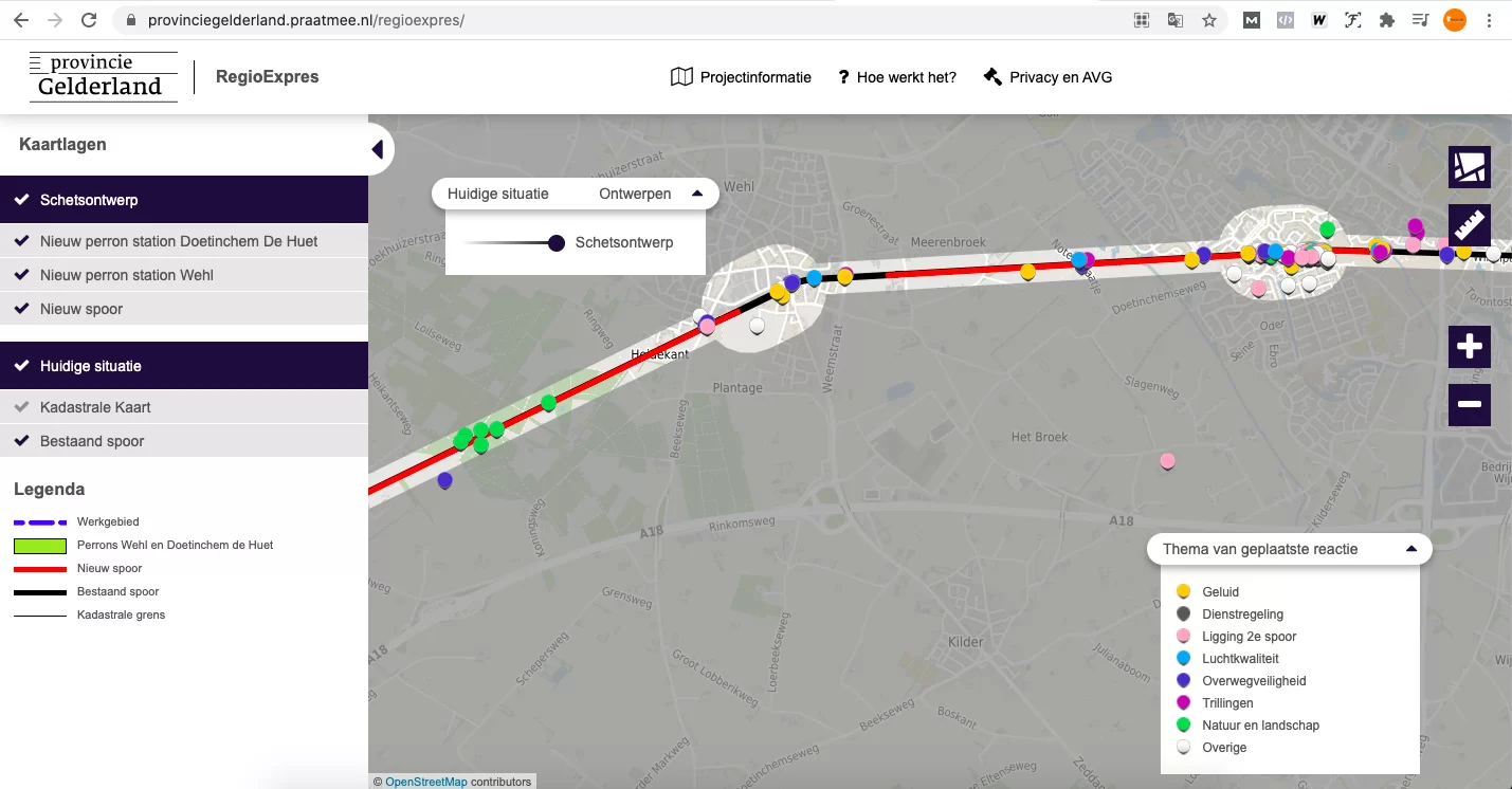
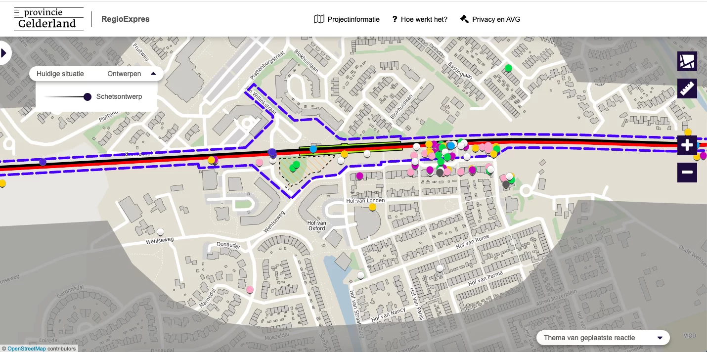
But what will be the impact of this doubling? To involve all stakeholders, we developed a MapTalk app for the Province of Gelderland under the guidance of the environmental manager, Jan van de Wouw. The draft designs, complete with new platforms, construction areas, and new crossings, provide an impression of how the new rail line might look. Online, people can indicate where they experience issues along the route or share innovative ideas.
MapTalk Debut
This marks the first time MapTalk has been utilized for railway management. And it proved particularly suitable for combining various interests. The Province of Gelderland, municipalities of Montferland and Doetinchem, ProRail, Arriva, and Connexxion: MapTalk’s online environment provides all involved parties the opportunity to collectively assess a coherent draft design. GeoApps & MapTalk project leader Ryan Beij assisted in translating all interests into one user-friendly map.
Preferred Alternative to Follow
The Province of Gelderland also used MapTalk as a central point for feedback during three online information sessions. All responses were deemed "highly valuable." Trends and similarities are immediately visible on the map thanks to the accumulation of colored dots.
The consultation period on the proposal for the Exploration and track doubling of RegioExpres, along with the participation plan, constituted the first step in this process. After the exploration phase, the Gelderland Provincial Council will decide on the preferred alternative. This is expected to occur by the end of 2021 or the beginning of 2022. The MapTalk app will remain available online until the end of this year for consulting the draft designs.